Phone: (765) 973-9349
FAX: (765) 973-9321
Request More Information Here
WCRIC Online Maps
Barn Photo Inventory
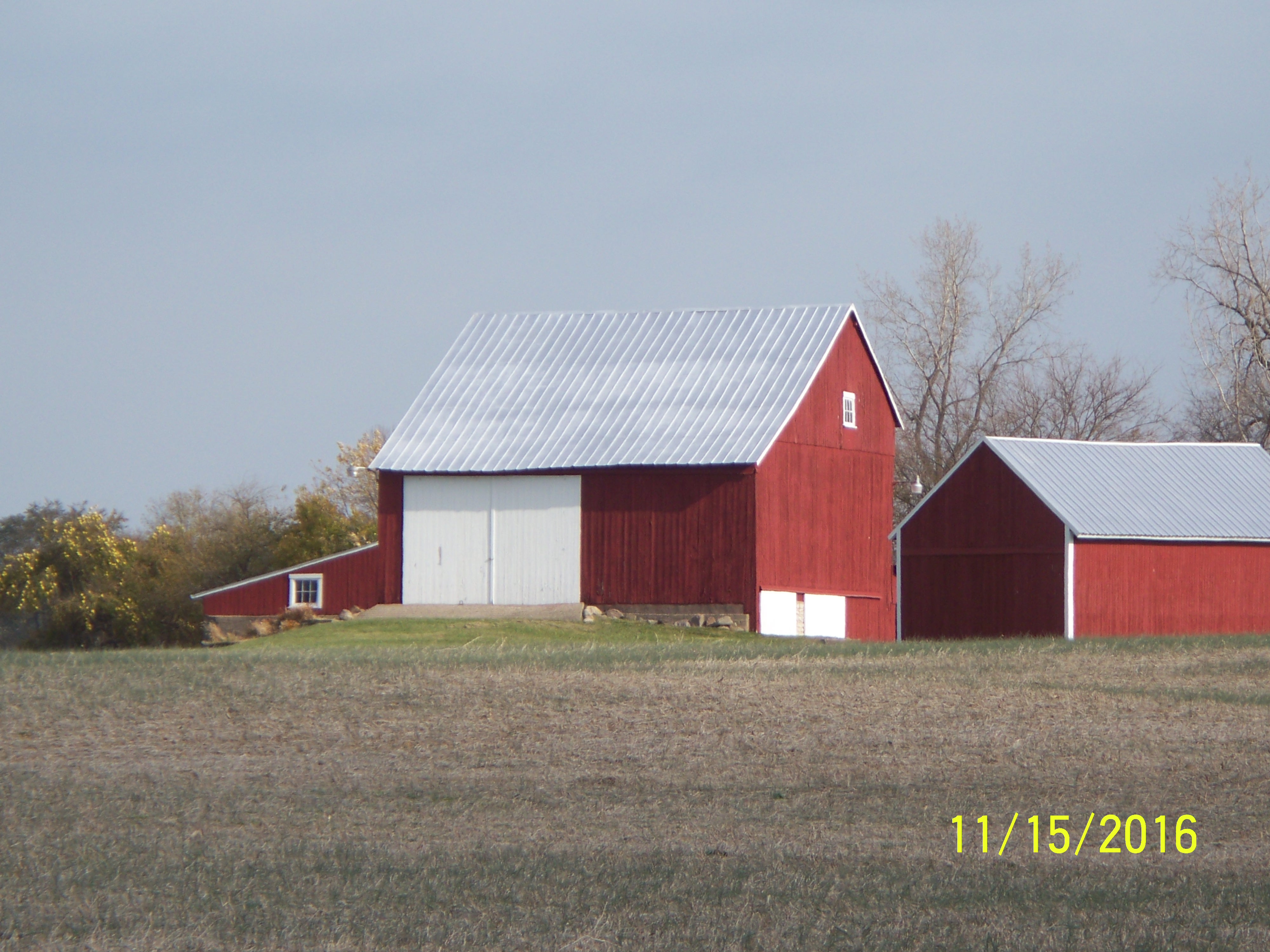 |
Funded by the Wayne County Resource Inventory Council and the Wayne County Foundation. The Inventory of over 700 barns includes a report with a photo collection of each structure. | 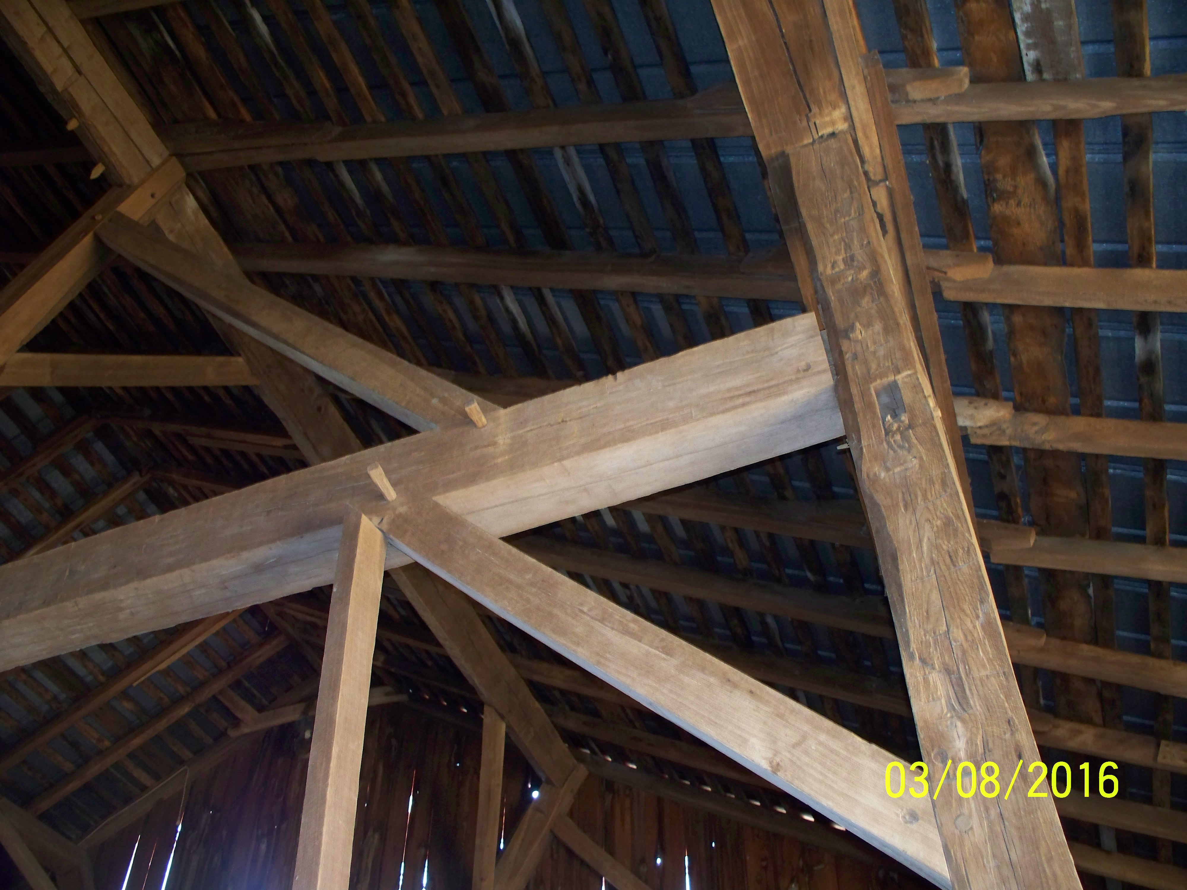 |
Click here to view dynamic map of the barn inventory
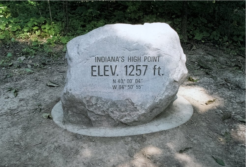
Highest Point in Indiana - Hoosier Hill
|
Wayne County is the home of the highest point in Indiana and some volunteers from the WCRIC, inspired by an Eagle Scout from Lakeside Park, KY, have taken on the task of maintaining and promoting the site. The WCRIC provides promotional material and many improvements have been made with the generous support from the National Highpoint Society.
More information on Hoosier Hill is available at: Waynet-Hoosier Hill Info Watch Highpointing: Hoosier Hill, the highest point in Indiana – Rooftops of America on Youtube |
Wayne County Driving Tour Is now available as an interactive web map: https://storymaps.arcgis.com/stories/34f6ff9b7759449799b728852f6143ac
Land Use Maps Contents
Why a Resource Inventory?
How Can the Inventory Maps Be Used?
Other Resource Information Sources
Available Resource Maps
Narrative for the Resource Maps
Other Available Resource Inventory Council Materials
Location of Materials
WCRIC Membership
WCRIC Funding
The land that we use for all aspects of our civilized lives has its own qualities which make it suitable for some uses and unsuitable for other uses. These qualities need to be considered when plans are being made to alter land uses. Wayne County Resource Inventory Council (WCRIC) has inventoried and mapped Wayne County land so that accurate data describing the land can be available for making the best planning decisions possible.
How Can the Inventory Maps Be Used?- to predict groundwater availability
- to locate flood plains
- to determine general soil types
- to determine general geology
- to estimate depth to bedrock
- to evaluate underground bedrock surface
- to locate special natural features
- to locate special historic features
- to identify existing Land uses
- to locate utility lines and conduits
- to locate county zoning boundaries
- to determine general topography
- to locate old dump sites
- for teaching purposes
This data makes possible planning for appropriate location of subdivisions, industrial and commercial areas and farmlands as well as the correct location of utility pathways and surface water drainage ways.
Other Sources of InformationFurther detailed information may be obtained from Wayne County and city planning departments and the Natural Resources Conservation Service at their National or Indiana State Offices.
Available Resource Maps:
Printed copies of all maps are also available for purchase in the Wayne County Planning Department. Printed maps are scaled at 1 inch = 6000 feet. RIC Online Maps
- I. Base Map With Section Lines- Shows highways, roads, railroads, streams with permanent flow, cities, towns, and villages, section lines and numbers for location of points for GIS.
- II. Zoning Map- Shows generalized zoning districts in the county. Specific zoning demarcation must be checked with the respective county or town agencies.
- III. Utility Map- Shows underground and overhead utility lines, gas lines, electric lines, water mains and sewers outside corporation limits. Telephone lines are not shown.
- IIIa. Communications Map- Shows Cell Towers, Railroad Towers, Internet Sites. Online tower search https://wireless2.fcc.gov/UlsApp/AsrSearch/asrRegistrationSearch.jsp.
- IV. Water Resources Map- Shows available water and oil well drill data. Online well data available on below link https://www.in.gov/dnr/water/ground-water-wells/water-well-record-database
- IVa. Water Availability Map- Shows general water availability based on extrapolation of well drill data.
- IVb. Water Quality- USGS data for the Great and Little Miami River Basins Available on below link https://www.usgs.gov/centers/oki-water/data-tools
- V. General Geologic Features Map- Shows sites of bedrock, glacial geology and soil types.
- VI. Depth To Bedrock Map- Shows depth from land surface to underlying bedrock surface.
- VIa. Bedrock Elevation Map- Shows surface of underlying bedrock using contour lines.
- VII. Land Use/Ground Cover Map- Shows forests, Agricultural areas, quarries, wetlands and orchards.
- VIIa. Land Use/Development Map- Shows the placement of all manmade structures.
- VIII. Natural Areas Map- Shows natural areas of special biological, geological, and aesthetic interest.
- IX. Historic Sites Map- Shows historic sites currently visible.
- IXa. Remaining Early School Buildings- Shows locations of early school buildings and sites that were remaining as of 2019.
- X. 1874 History Map-Shows turnpikes, railroads, canals, treaty lines, and historic sites based on the 1874 atlas.
- XI. Flood Hazard Analysis Map- Shows areas subject to flooding during a 100 year period.
- XII. Topographic Map/ 50 Foot Contours-Shows general county topography.
- XIII. General Soils Map- Shows broad areas that have a distinctive pattern of soils, relief, and drainage- for use in general planning only. Also shows description of land use capabilities. USDA online soil map https://websoilsurvey.sc.egov.usda.gov/App/HomePage.htm
- XIV. Potentially Suitable Landfill Sites Map- Shows potentially suitable sites for an environmentally acceptable landfill based on geological and soils data.
- XV. Former Dump Sites Map- Shows sites previously used for dumping waste.
Other Available Resource Inventory Council Materials
- 18 Printed Resource Maps* - 1 inch = 6000 feet.
- Map Narratives* - written description of each of the 18 resource maps.
- Wayne County Historic Sites Booklet*
- Check Before You Buy or Build - brochure.
- Land Resource Guide for Planners and Builders - a planning guide for land use changes
- Arrangements may also be made for local presentations to service clubs and other groups by a representative of the RIC.
- CD Driving Tour of Wayne County 6/2010. Price $7.50 includes map, booklet and CD.
- CD RIC maps and Narrative including information maps and schools report. Price $10.00.
- Report of early school buildings remaining in Wayne County in 2005. Rev 2019. Price $10.00 for Booklet.
* denotes nominal fee charged
The Wayne County Historic Sites Booklet contains a brief county history and a description of both the national historic inventories and the Indiana Historic Sites and Structures Inventory that were used in classifying historic structures in the county.
The Historic Sites booklet contains individual township, town and city maps showing cemeteries, historic markers, locations of toll houses, historic districts, and all buildings and structures rated "Outstanding" on the 2001 Indiana Historic Sites and Structures Inventory.
All materials available at:
The Wayne County Planning Department
Wayne County Administration Building
Richmond, Indiana 47374
Phone (765) 973-9249
The Resource Inventory Council is composed of members representing government, civic, commercial, agricultural, environmental, industrial and educational organizations.
WCRIC FundingWayne County provides funding support. Additional support comes from the County Surveyor, County Planning Office, Richmond City Engineer, and Richmond Planning Office.
Funding for special projects has been provided by the Wayne County Foundation, Society for the Preservation and Use of Resources, and Richmond Board of Realtors.